
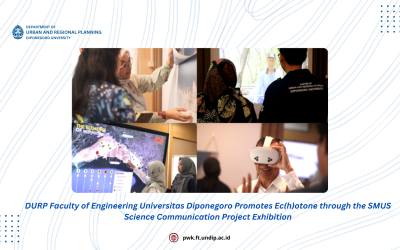
DURP Faculty of Engineering Universitas Diponegoro Promotes Ec(h)otone through the SMUS Science Communication Project Exhibition
As part of Universitas Diponegoro’s (Undip) role as a core partner in the Global Center of Spatial Methods for Urban Sustainability (SMUS) network, coordinated by Technische Universität (TU) Berlin and funded by the German Government, the Department of Urban and...
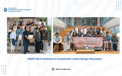
UNDIP-NUS Initiative on Sustainable Urban Design Discussion
Department of Urban and Regional Planning, Faculty of Engineering, Universitas Diponegono (UNDIP) and the National University of Singapore (NUS) discussed Sustainable Urban Design (SUD) in May 2025 to enhance collaboration and knowledge in the field of sustainable...
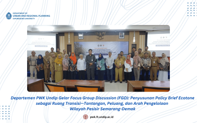
DURP Faculty of Engineering Undip Held Focus Group Discussion (FGD): Formulation of Policy Brief on Ecotone as a Transition Area—Challenges, Opportunities, and Directions for Coastal Area Management in Semarang-Demak
The Department of Urban and Regional Planning, Diponegoro University, conducted a Focus Group Discussion (FGD) to support the arrangement of a Policy Brief entitled “Ecotone as a Transitional Space: Challenges, Opportunities, and Strategies for the Management of the...
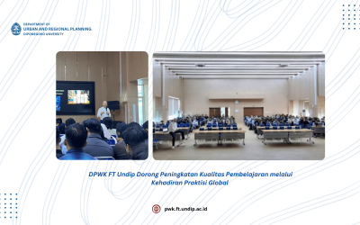
DURP Faculty of Engineering Undip Advances Learning Quality through the Presence of Global Practitioner
As a strategic step toward actualizing Universitas Diponegoro’s (Undip) vision as a World Class University, the Department of Urban and Regional Planning (DURP) - Faculty of Engineering Undip welcomed Neville Mars, PhD from Mars Architects through the WCU Practitioner...

DURP Faculty of Engineering Undip Enhances Global Reputation through an International-Scale Adjunct Professor Program
As part of the efforts to strengthen internationalization toward Diponegoro University’s (Undip) vision of becoming a World Class University, the Department of Urban and Regional Planning (DURP) of the Faculty of Engineering Undip has appointed Prof. Dr. Walter Timo...
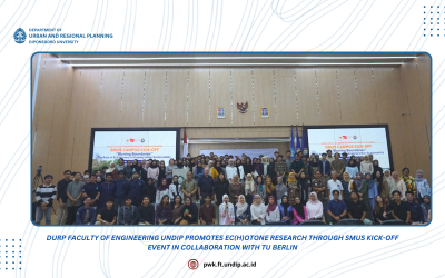
Durp Faculty Of Engineering Undip Promotes Ec(H)Otone Research Through Smus Kick-Off Event In Collaboration With Tu Berlin
The Department of Urban and Regional Planning (DURP), Faculty of Engineering, Universitas Diponegoro (Undip) as a core partner in the Global Center of Spatial Methods for Urban Sustainability (SMUS) network coordinated by Technische Universität (TU) Berlin and...
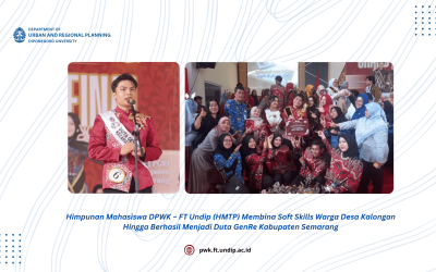
The Department of Urban & Regional Planning Student Association – Faculty of Engineering, Diponegoro University Develops Soft Skills of Kalongan Village Residents, Leading to Success in GenRe Ambassador Contest in Semarang Regency
The Urban and Regional Planning Student Association (HMTP) – Faculty of Engineering, Diponegoro University, through Desa Binaan program and in collaboration with Calista Kisy Shintia, a 2023 Urban and Regional Planning student at Diponegoro University who currently...
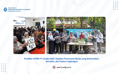
Pendikar DURP Undip 2025: Preparing Young Planners with Character, Ethics, and Environmental Awareness
The Department of Regional and Urban Planning, Faculty of Engineering, Diponegoro University (Undip) has held a series of Character Education (Pendikar) events as part of the Introduction to Campus Life for New Students (PKKMB). A total of 242 new students from the...
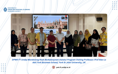
DPWK FT Undip Promote Sustainable Research Visiting Professor Program: Prof. Alex Lo from York Business School, York St
To strengthen international collaboration, the Department of Urban and Regional Planning (DURP), Faculty of Engineering, Diponegoro University, is committed to supporting the university’s vision of becoming a world-class research university. One of the strategies...
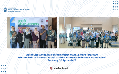
The 6th Geoplanning International Conference and Scientific Consortium Brings Together International Experts to Discuss Urban Resilience Through Disaster Risk Modeling
The Geomatics and Planning Laboratory, Department of Urban and Regional Planning, Faculty of Engineering, Diponegoro University successfully organized the 6th Geoplanning International Conference and Scientific Consortium on Wednesday–Thursday, August 6–7, 2025. This...